
The Nile: Egypt's Endangered Lifeblood
The Nile River has sustained Egypt's civilization for thousands of years, but today is challenged by unprecedented threats.

The triangle-sailed felluca is an icon of the Egyptian Nile.
This is the fifth in a six-part series on my 2017 trips to Egypt. Read previous entries here: "To Egypt, At Long Last", "Daily Life in Giza, Straight from the Horse's Mouth", "Cairo, Conqueror of Skeptics", "Ancient Egypt in the Modern World: Touring the Pyramids, Luxor, and Beyond".
On the map, Egypt looks like a hefty yellow block, roughly as wide as it is long. But so central is the Nile River to life there that nearly all 99 million Egyptians live in just four percent of the country's land, within the two narrow ribbons of habitable green space that flank the Nile along its final 1,600 km course from the Sudanese border to the Mediterranean. (Because the river flows from south to north, geographic references are reversed, with "Upper Egypt" below "Lower Egypt" on the map.) Habitable points in the surrounding desert are few and far between.
The Nile has been the epicenter of Egypt's unusually one-dimensional, inverted geography for millennia. Traditionally, summer floods brought an influx of nutrient-rich waters from the Nile's source in central Africa each year, enabling the ancient Egyptians to plant the crops that sustained some of humanity's greatest empires. To set taxes each year, the pharaohs used specially designed "Nilometers" to measure the high-water mark of the annual floods; higher flood levels meant higher crop yields, and thus higher taxes. In Cairo, I visited the Nilometer at the southern tip of Rawda Island, descending narrow stairs down into a dark well past rings of discolored stone that marked long-ago flood waters.
The Nile doesn't flood anymore. Since 1970, with the completion of the Aswan High Dam, the Egyptian government can set the water levels, preferring a steady flow that enables predictable power generation and irrigation. Older Egyptians can still recall memories of the flood, however, and even my first Arabic teacher, Margaret Nydell, recounted to our class what life was like in the last years of the summer flooding, during her earliest days in Cairo.

For first-time visitors, the Nile serves as the essential landmark in the chaos of Cairo.
Today the river remains the lifeblood of Egypt, and an essential landmark for first-time visitors. Within the madness of Cairo, it is a great blue interruption, both orienting the mind and refreshing the senses amid the otherwise confounding urban geography. To get another view of the city—or to escape it—you can board raucous party boats, rowing sculls, small cruise ships, or traditional felluca sailboats from docks all along the riverbank. Felluca rides in Cairo, Luxor, and Aswan stand out among my most fond memories of our trips to Egypt.
During our year-end holiday, Nina and I and our families took a three-day Nile cruise from Luxor to Aswan, where I got a whole new view of the river. At many points along our route, the brilliant band of green flanking the river narrowed dramatically, yielding abruptly, just a stone's throw from the shallows, to the yellow wasteland beyond. We passed numerous ancient riverside ruins, stopping at the largest temples for guided visits. Near Aswan, we visited a site where the ancient Egyptians used little more than wooden pegs and river water to split solid granite and extract colossal pillars, which they carved into obelisks to be floated downriver on barges. Again, the modern intruded in unexpected ways on the ancient: Some mornings, we would wake and climb to the ship's viewing deck to find that during the night we had been lashed to other cruise ships in a huge flotilla, their early morning muzak tunes competing with one another to spoil the day's tranquil early hours.
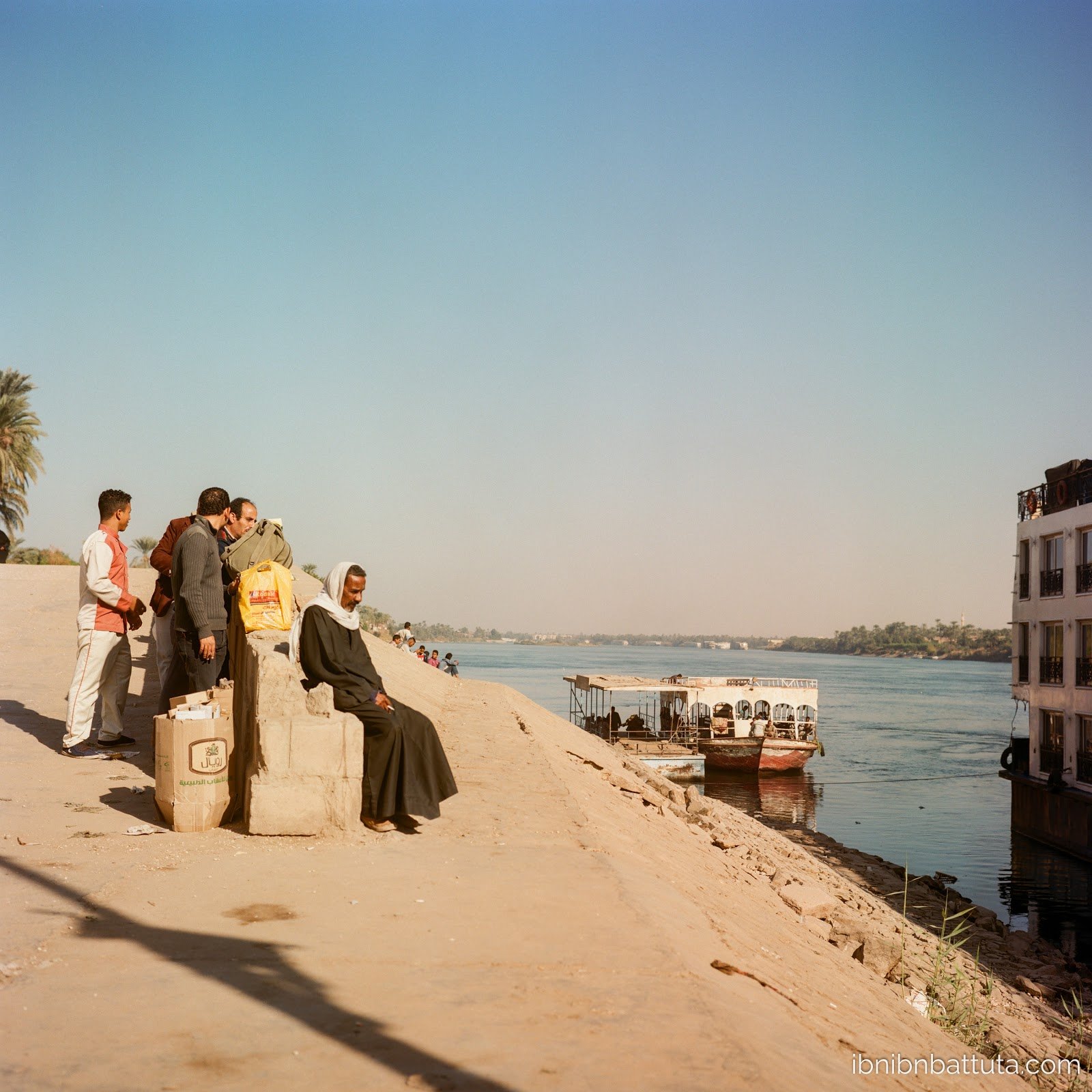
Passengers wait to board a cruise ship near Luxor.
Even beyond the cruise ships, the ever-expanding urban development, and the dam that ended the Nile's annual floods a generation ago, the modern world is bringing many changes to the river that gives Egypt life. Receding water levels, pollution, and a rapidly expanding population are stressing the Nile's capacity to sustain the millions who depend upon it. Along with Egypt's domestic politics, the country's ongoing negotiations with Ethiopia—an emerging regional juggernaut that has the advantage of being upriver—will play a large role in determining events in years to come. For more on these issues, read Ayah Aman's "Death of the Nile" (Al Monitor, May 2019) or Jennifer Derr's forthcoming The Lived Nile: Environment, Disease, and Material Colonial Economy in Egypt.
My Rolleiflex photos from Egypt are available in two albums: 2017 Rollei - Egypt I and 2017 Rollei - Egypt II. Nina's photos from our first trip are here: 2017.07 Egypt.
Coming next: My conclusion to this Egypt series with reflections on the country's political economy.

Pharaonic ruins flank the Nile, a reminder of the civilizations it has supported for millennia.